
Cala en Tió
Andratx · Mallorca
 Weather in Andratx
 The beach
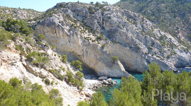
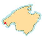
Cala en Tio is a rocky cove with a small sandy area located between Sant Elm and the Port of Andratx. The area is surrounded by high cliffs least in it's western side where there is a slope: At first you may help with the trees to drop, but there comes a point where it is dangerous to continue the descent.
Notes
Inaccessible cove with large slope. We recommend arrive by boat or kayak. The area has several trails that connect s'Arracó, Sant Elm and Es Pas Vermell. We arrived at the cove thaks to @Lara_Seda.
Restaurants
Nearby restaurants NO RESTAURANTS CLOSE TO THIS AREA
Video
 What this beach has
 Photos of Cala en Tió
How to get there
- 1Sant Elm
We head to the municipality of Andratx and continue towards the town of s'Arracó. Then continue towards Sant Elm.
- 2Cala Conills
Arriving in Sant Elm, we will continue to our left in an east direction along Carrer es conills. It is a dead-end street that ends on the easternmost side of the town. We have to park in Cala Conills.
- 3path
This street ends up widening, it looks like a roundabout. Here we will look for a path that many cyclists use. The path goes up a small slope.
- 4esplanade
We will climb for about 10 minutes until we reach a small fenced esplanade with a sign indicating "private property". We will not step on this area, we will continue along the path that we can see that surrounds this area.
- 5red rope
Following the path we will come across a red rope that crosses the path, it is tied to two trees so that vehicles do not circulate. Once you have passed the rope we must continue along the next path on our right. There are red markings on a landmark.
- 6make way
This detour will take us to a very high point on the coast. From here you have to make your way to the east (our left) between pine trees, we will see little by little that a slope begins and soon after we will have views of Cala en Tió. At first it is possible to descend with the help of trees but there will come a point where it is dangerous to continue.
Where it is
 Other beaches near Cala en Tió
About Andratx
Andratx is a municipality in Majorca located in the southwest of the island and belonging to the Sierra de Tramuntana (Tramuntana mountain range). It is 30 km away from Palma bordering on Calvià and Estellencs. Andratx has several urban nuclei: Andratx, Port of Andratx, s'Arracó, Sant Elm and Camp de mar. Andratx is one of the Majorcan municipalities with a larger number of foreign residents. Near this municipality we find the Dragonera island, nature reserve from 1995 which can be reached by boat trip.
